High tides and broken records on the Upper Severn Estuary

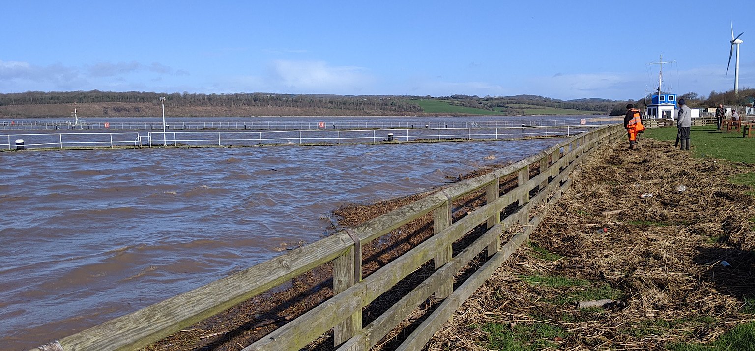
The above photo shows peak high tide at the entrance to Sharpness Docks on the morning of 12th March 2020. The familiar scene is nearly unrecognisable as the two wooden piers are almost submerged.
This was forecast to be the highest tide of the month: 10.74 metres at Sharpness. The water does look very high but was this actually the highest tide?
That same morning, record high tides were recorded a few miles upstream at Longney and Epney where unfortunately there was flooding.
However, at Sharpness, the over-spilling driftwood in the photo was deposited by the tide the evening before.
So there, the previous tide was visibly higher despite its lower forecast of 10.54m. How come?
The tide timetables and predicted heights take into account the positions of the moon, the sun and other celestial bodies. Those positions can be predicted with precision but the exact times and heights of tides cannot. Why not?
On the morning in the top photo, it was a pleasant day with just a bit of a breeze. The evening before it was wet and windy – not stormy but blowing with a stiff breeze and some gusts. That difference in wind made the tide higher.
This is illustrative of tidal surge.
What is a Tidal Surge or Storm Surge?
A tidal surge happens when wind or a low pressure weather system causes extra forward movement of water. This results in a higher than predicted tide.
A tidal surge can last for hours or days.
These tidal surges should not be confused with tsunamis, tidal bores, or the usual surface waves.
Tidal surges are usually associated with stormy weather – they are often called ‘storm surges’ and can cause coastal flooding.
The low atmospheric pressure within a storm also causes sea water expansion which raises sea level and further increases the high tide level.
Astronomical Tide + Meteorological Tide.
The forecast tide is most influenced by the position of the moon, then the sun, then other celestial bodies. For this reason is it called the ‘astronomical tide’.
The additional tide created by weather conditions and which causes tidal surges is called the ‘meteorological tide’.
Here on the Severn Estuary, our astronomical tides have the second greatest range in the world.
You could say that we have astronomical astronomical tides!
In comparison, the meteorological tide here is usually of little consequence. It will contribute to flooding only when a tidal surge coincides with the higher spring tides of spring and autumn.
A storm surge during a neap high tide – typically around 5 to 6m – will not raise the tide to the 10m level of a spring high tide.
Are we exposed here?
Here in the upper Severn Estuary, we are less exposed to surface waves than down in the Bristol Channel. And the famous Severn Bore gathers its splendour further upstream of Sharpness.
However, the upper estuary is significantly more exposed to tidal surges. The estuary’s shape has a funnelling effect which amplifies the surge.
A major storm surge in January 2014 added water heights of up to 0.84m at Hinckley Point, 0.99m at Portbury, 1.2m at Oldbury, 1.96m at Sharpness, and a massive 3.58m further up-estuary of Sharpness.**
The effect of weather on high tides is difficult to predict, especially as it will vary from one locality to another. The height and duration of a tidal surge has been found to depend on many things including the distance up-estuary, local estuary shape and depth, and tidal-surge interactions.
At Sharpness, the estuary is big enough that rain water coming down the River Severn is minor compared to the tidal waters. Further upstream towards Gloucester, high River Severn levels have much more of an impact, and meet with high tides to cause flooding.
Climate Change
Due to climate change, sea levels are rising and stormy weather is getting worse and more frequent. UK rainfall is forecast to increase by 30%. Our wet and windy weather generally comes across the Atlantic from the west or south west – the directions to which the Severn Estuary is most exposed.
When coastal flooding does occur due to a storm surge, it is likely that the river levels will also be very high. The rivers will not be able to drain out into the estuary at all during high tide. The result can be exacerbated river flooding in addition to coastal flooding.
Locals can easily observe that the water levels in our short local rivers – the Little Avon and the Cam – do rise rapidly and dramatically in response to heavy rainfall draining down from the Cotswold edge. This means that very high river levels are likely to coincide with a storm surge.
Climate change is not something we should take lightly here in Berkeley Vale, or anywhere else.
**Source: Uncertainty in estuarine extreme water level predictions due to surge-tide interaction – pages 15 & 19.


